
GIS and Maps
Announcements and New Content
Request for GIS Maps or Data
To request GIS maps or data, please do so through our online Services Viewpoint Cloud portal. The direct link to the GIS request form is: https://salemma.viewpointcloud.com/categories/1096/record-types/6579
The link to Salem's online Services Viewpoint Cloud portal with request forms for all City Departments is: https://salemma.viewpointcloud.com/
NEW C-ROD Coastal Resiliency Overlay District Mapping Available
A new C-ROD Coastal Resilience Overlay District that would establish new standards for resiliency to projected worsening coastal flooding is under consideration for adoption. The new C-ROD Information page contains a GIS interactive web map that allows user to find the projected 2070 Sea Level Rise Base Flood Elevation (SLR BFE) for any location inside the new overlay. Also included is a pdf map showing borders of C-ROD, and other information. The following Zoning maps and resources have also been updated:
Roadway Surface Rating Survey Map
This interactive online map allows residents to easily look up and view the color-coded road surface rating condition, and recommended paving plan for any segment of the City’s nearly 100 linear miles of public roadway by clicking on the road segment. Salem began evaluating the objective conditions of its roadways in 2010 and, in partnership with the engineering firm BETA, continues to update the road surface ratings and monitor conditions. Road surface ratings, which score from 0 (the lowest) to 100 (the highest) help inform the City’s annual multi-million dollar paving plan allocations and allow the City to set a realistic paving budget based on the repair type necessary for the road segment’s condition. Roadway Surface Rating Survey Map
Updated Street Sweeping Information
Please use the following city website for all spring through fall 2024 street sweeping related information: Street Sweeping Central Website
Tax Maps for Fiscal Year 2024
The maps are available here.
Updated Snow Plowing Information
Please use the following city website for all current season snow related information: Snow Central Website
Food Assistance Resources
We have teamed up with Salem Together and the Salem Health Department to bring you a complete revamped food assistance webmap. Use this map to locate food assistance resources like food banks, meal deliveries and more, across Salem.
Please access the webmap here.
Natural Gas Leak Data Portal and 2019 Report
Under new legal regulations, National Grid is now required to reporting the locations, repair status and details of all reported gas leaks throughout the Commonwealth. SalemGIS will be here to report that data to you through our new data portal. The Salem Natural Gas Portal includes maps, data summaries, downloadable datasets and tons of information regarding natural gas leaks and what is being done about them here in Salem. Please use the links below to gain access to the data portal and the 2019 report.
Geospatial Content Library
Downloadable Maps
- Zoning Map (no overlays) NEW
- Individual 2023 Precinct Maps NEW
- Street Index Map 2023 NEW
- Trash and Recycling Map 2023 NEW
- Wall map: All Wards & Precincts 2022 NEW
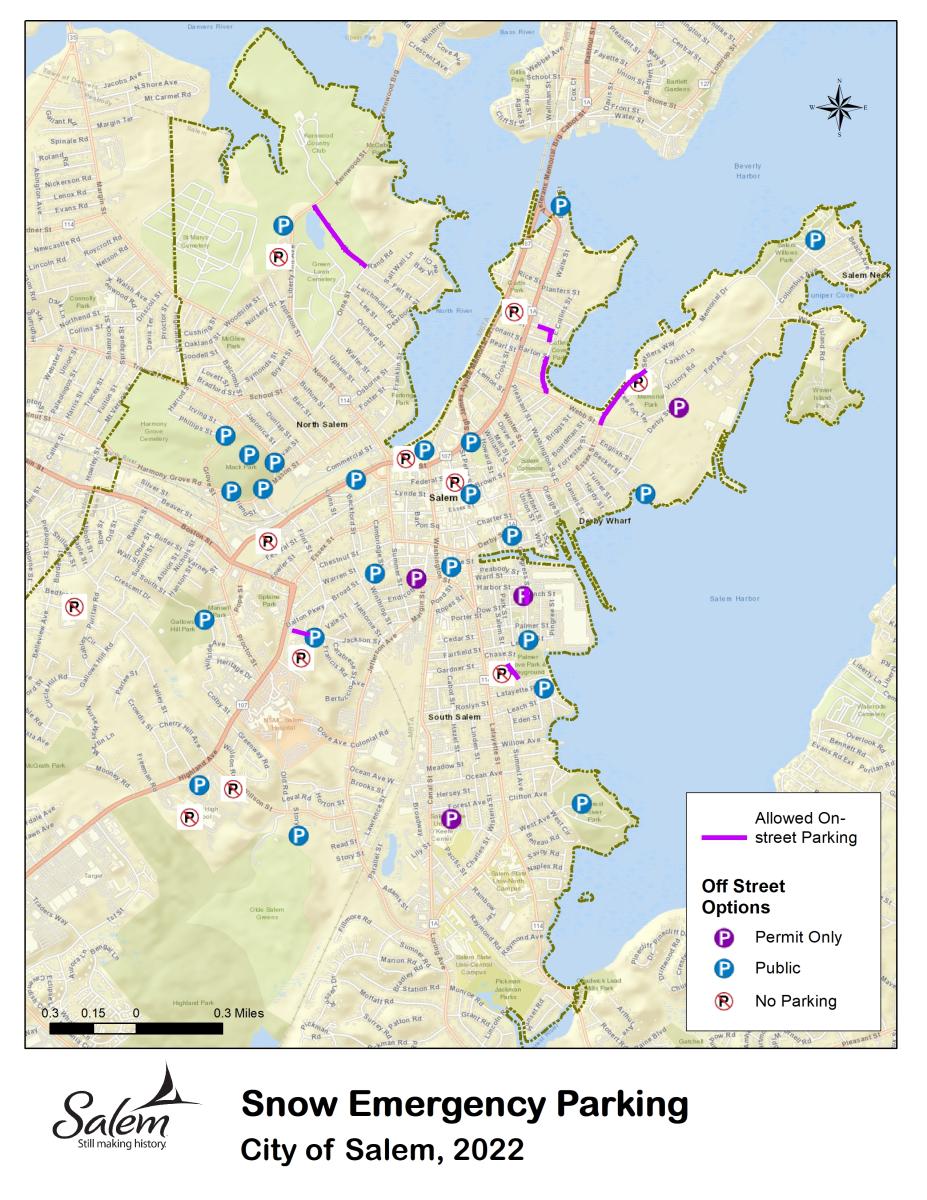
- Snow Emergency Parking (valid for 2023-4)
- Local Historic Districts
- National Register Historic Districts & Landmarks
- North River Canal Corridor Zoning District
- Low and Moderate Income Areas
Interactive Web Maps and Applications
- Natural Gas Leak Data Portal
- Food Assistance Programs
- Capital Projects
- Hurricane Evacuation Zones
- Downtown Tree Planting Project
- View Coyote Activity
- Salem Veterans' Memorials, Squares and Parks
- Salem Climate Hazard Viewer
- Snow Emergency Parking
- Food Resource App
- Urban Tree Inventory
- Street Sweeping
- Trash and Recycling Days
- Parks and Trails
- Salem Cigarette Recycling Program
- Local Historic Districts
- National Register of Historic Districts & Landmarks
Staff Contacts
| Name | Title | Phone |
|---|---|---|
| Vacant Position | Systems Analyst & GIS Coordinator | 978-619-5644 |
| Maria Josefson | GIS Technician | 978-618-5641x46105 |
